In-House 3D Laser Scanning & FAA-Certified Drone Operations for Industrial Engineering
CPE deploys company-owned terrestrial laser scanners and drones - operated by FAA Part 107 certified pilots - to document existing conditions from feasibility through construction. Capture the data that drives better decisions, reduces design surprises, and lowers total project lifecycle costs.
CAPTURE METHODS
How CPE Captures Existing Conditions
CPE owns and operates all reality capture equipment in-house - no subcontractors, no third-party survey firms. The right capture method is selected based on engineering requirements, site conditions, and downstream data use.
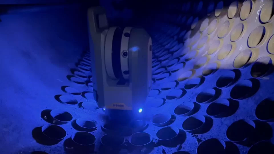
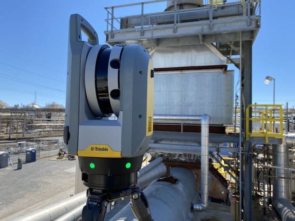
Terrestrial Laser Scanning
CPE Equipment
Best suited for
How it supports engineering
Typical use case
Drone Photogrammetry
CPE Equipment
Best suited for
How it supports engineering
Typical use case
Drone LiDAR
CPE Equipment
Best suited for
How it supports engineering
Typical use case
THE DATA
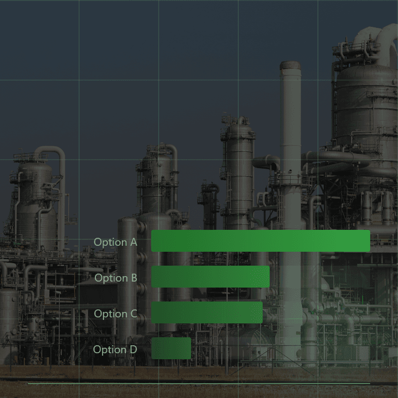
Why Plants Are Moving to 3D Scanning
Faster capture, fewer site visits, and lower total project cost. Based on a representative industrial facility survey.
0%
Less Time on Your Plant Floor
10 vs 20 man-hours on site
0%
Lower Total Project Cost
Net of equipment and crew costs
0x
More Data Points Per Day
888 million vs 960 with traditional measurement
| Metric | Traditional Survey | 3D Scanning |
|---|---|---|
| Data points per day | 960 | 888,000,000 |
| Man-hours on site | 20 | 10 |
| Total project hours | 59 | 28 |
Based on a representative project comparison for a typical industrial facility survey. Actual results vary by project scope and site conditions.
DELIVERABLES
What You Receive
Terrestrial and UAV merged point clouds, photogrammetry models, and 3D models drawings in industry-standard formats - ready for engineering, fabrication, construction, or owner archival. Every deliverable serves the project's downstream engineering needs, not just raw data handoff.
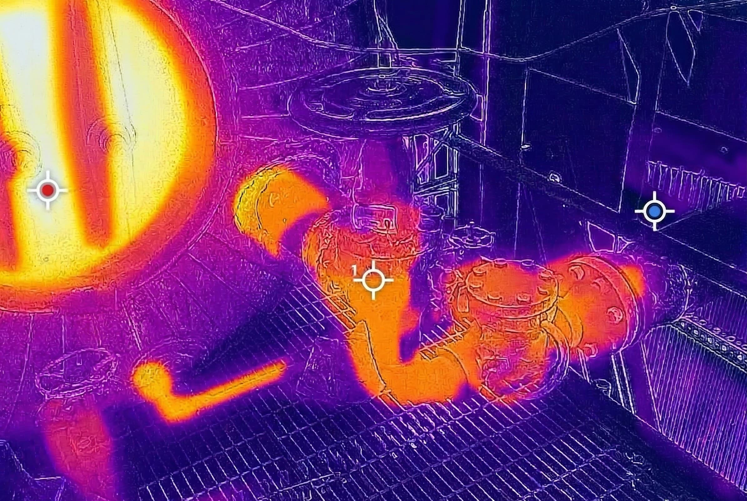
Scan Campaign Documentation
Field scanning, drone capture, and data processing for industrial engineering projects.
3D Laser Scanner
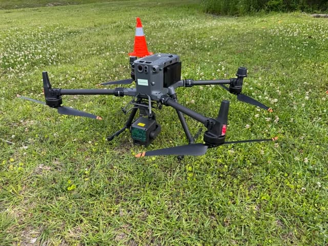
M350 & Zenmuse L2

RTK GPS Base Station

Photogrammetry Model
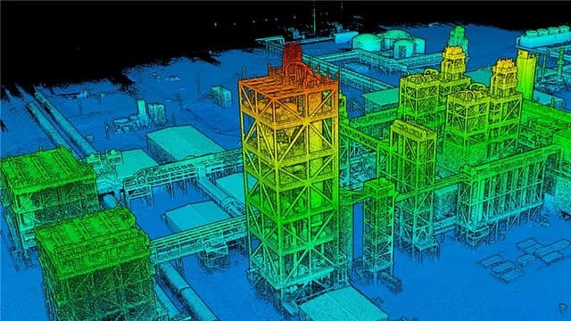
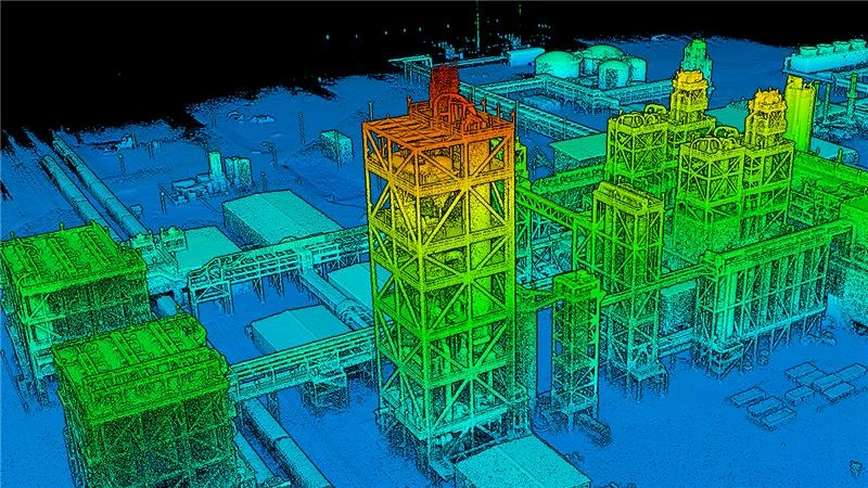
UAV LiDAR Point Cloud
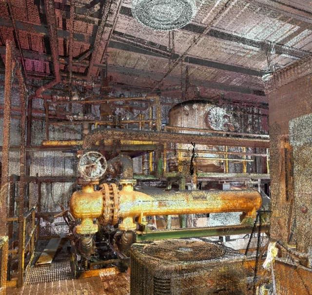
Terrestrial Scanner Point Cloud
3D Laser Scanner
M350 & Zenmuse L2
RTK GPS Base Station
Photogrammetry Model
UAV LiDAR Point Cloud
Terrestrial Scanner Point Cloud
3D Laser Scanner
M350 & Zenmuse L2
RTK GPS Base Station
Photogrammetry Model
UAV LiDAR Point Cloud
Terrestrial Scanner Point Cloud
Point Cloud Files
Processed .rcs and .rcp (Autodesk ReCap) files, Trimble .tdx native format, and .LAS files for drone LiDAR. Colorized point clouds compiled into unified project files for multi-area campaigns. Delivered on portable media or via secure file transfer for large datasets.
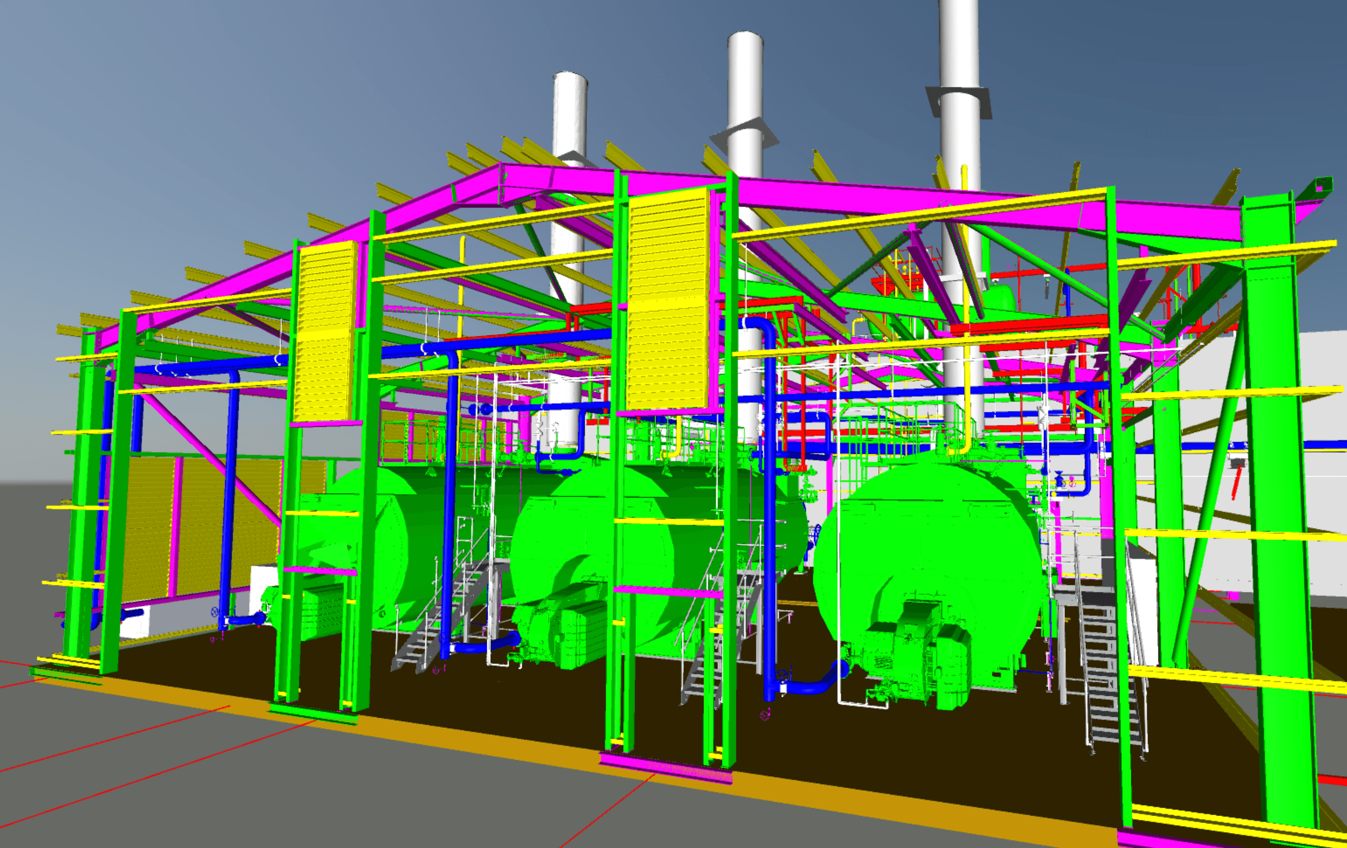
3D Models
Autodesk Plant 3D solid models in .dwg format, Navisworks .nwd files integrating point cloud with intelligent model, and SolidWorks models where required.
2D Drawings From Scan
General arrangement drawings, elevation cuts, fabrication drawings for replacement components, as-built P&IDs, and demolition drawings derived from scan data.
Clash and Interference Reports
Documented interferences between existing conditions and proposed designs, with photographs, point cloud screenshots, and dimensional data for resolution. Delivered as a standalone report or integrated into the engineering design package.
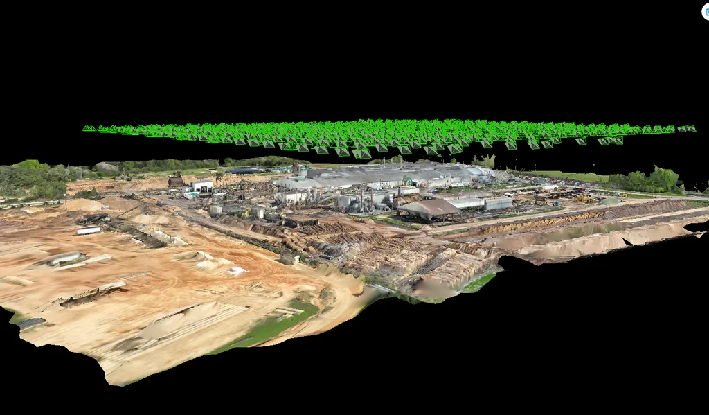
Photogrammetry Outputs
Georeferenced orthomosaic maps, 3D textured mesh models (.obj, .ply), and DJI Terra project files. Photogrammetry deliverables provide true-color, photorealistic site documentation for project communication, construction planning, and owner records.
APPLICATIONS
What the Scan Data Feeds
CPE's reality capture is integrated with engineering - not a standalone survey service. Scan data feeds directly into feasibility, design, fabrication, and construction, reducing total project lifecycle costs with accurate existing-conditions data from day one.
Feasibility & Pre-Engineering
Engineering Design Support
Clash Detection
Fabrication Drawings from Scan
Construction Verification & As-Built Documentation
PROJECT EXAMPLES
Featured CPE Case Studies
Power Boilers
BFB boiler for high-moisture biomass - South America
Complete BFB boiler design for a biomass facility in South America, handling high-moisture fuels with custom combustion and heat transfer engineering.
Debottlenecking
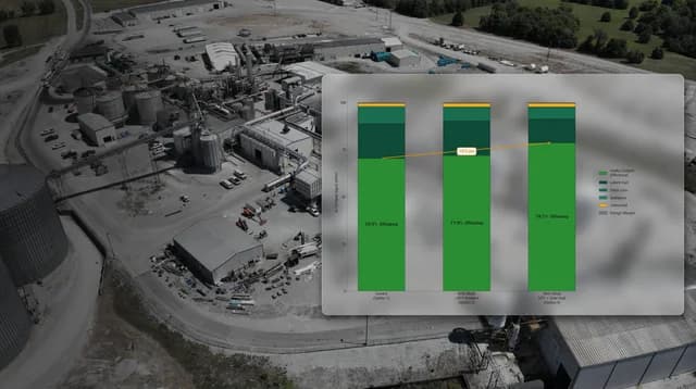
Biomass boiler capacity limits identified across 17 subsystems
Component-level performance and capacity assessment of boiler, fans, ESP, fuel handling & metering, ash handling, economizer, air heater, multiclone and emissions controls systems. Boiler and appurtenant systems were modeled at existing and target conditions to identify bottlenecks and areas for improvement, required to achieve target conditions. Capital cost estimates were then provided for each option for determination of the best option to proceed with.
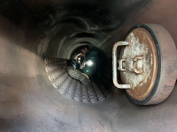
Root-Cause Investigation
Steam contamination pathway traced to source
Multiple contamination pathways identified across the steam and condensate systems. However, the primary driver for the issue was galvanic corrosion in galvanized piping downstream of an RO system. Corrective actions and appropriate metallurgies were identified and deployed.
APPROACH
Typical Reality Capture Engagement
Structured from scoping through delivery - every scan campaign is planned around the engineering need. Reality capture engagements are initiated at any project stage, from early feasibility through construction support.
Project Scoping
Define scan coverage, deliverable formats, accuracy requirements, and downstream data use. Scan campaigns are frequently initiated during feasibility - not only at detailed engineering.
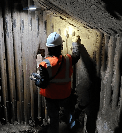
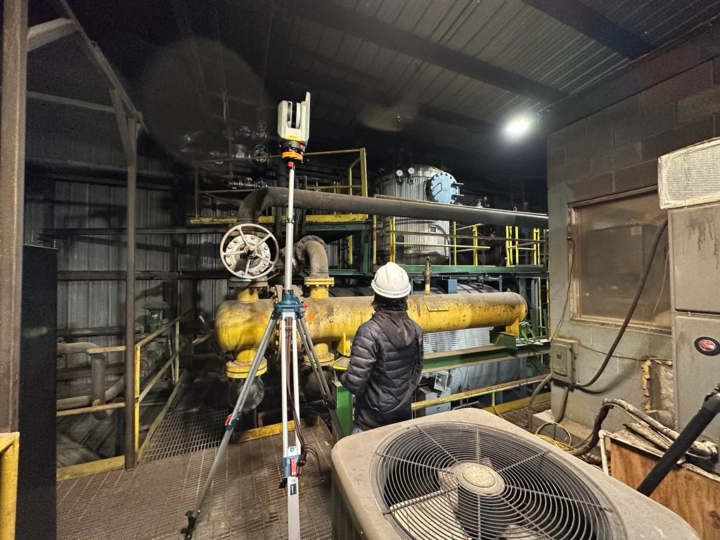
Field Capture
Deploy terrestrial scanners and drone to capture point cloud and photogrammetry data. All drone operations are conducted by FAA Part 107 certified pilots, with flight plans coordinated with facility safety and operations.
Processing and Modeling
Register scans into a unified point cloud, process photogrammetry into orthomosaics and 3D meshes, build models in AutoCAD Plant 3D, and extract measurements and interference checks.
Deliverable Package
Provide point clouds, photogrammetry outputs, 3D models, 2D drawings, and clash reports in industry-standard formats ready for engineering, fabrication, or construction.
THE CPE DIFFERENCE
Scanning Integrated with Engineering
CPE does not sell scanning as a commoditized survey service. Every scan campaign is scoped, captured, and processed by the same team that will use the data for design - or delivered as a standalone service with the same equipment, quality, and engineering context.
Scan-to-Design, Not Just Scan-to-File
CPE’s scanning is integrated with engineering: the same team that captures the point cloud designs the new piping, equipment, or structural modifications. This eliminates the handoff friction between survey-only firm and engineering firm - and ensures the scan captures exactly what the design requires.
Industrial Plant Specialization
Boiler houses, process buildings, pipe racks, and heavy industrial equipment - not commercial buildings. CPE understands what to capture and what level of detail the engineering requires.
Combined Terrestrial and Aerial
CPE-owned Trimble X7/X9 terrestrial scanners paired with CPE-owned DJI M350 and M3E drones for photogrammetry and LiDAR. Ground-level interior detail merged with overhead exterior coverage in a single, unified deliverable. All drone flights conducted by FAA Part 107 certified pilots.
Engineering Context for Every Scan
Scanning is scoped based on what the engineering project needs: which areas, what pipe sizes to model, what level of detail for structural steel. No unnecessary data, no missing coverage.
FAA Part 107 Certified Drone Operations
All CPE drone operations are conducted by FAA Part 107 certified remote pilots with flight plans coordinated through facility safety and operations. CPE maintains current airspace authorizations and complies with all FAA regulations for commercial UAS operations, including sites near airports or in restricted airspace.
Reality Capture Services for Hire
Reality capture is also offered as a standalone service - scan campaigns, processing, and deliverables for clients who will perform their own engineering. Same equipment, same personnel, same quality. Terrestrial, drone, or combined campaigns scoped to your requirements.
LIFECYCLE COST
How Reality Capture Reduces Total Project Lifecycle Costs
Fewer field trips
A comprehensive scan campaign captures everything in one or two mobilizations - eliminating the repeated field measurement visits that add cost and schedule to every brownfield project.
Earlier, better decisions
Scan data deployed during feasibility provides accurate spatial context for equipment selection, layout planning, and cost estimation - before detailed engineering spend begins.
Clashes caught in the office, not the field
Overlaying design models on point cloud data identifies interferences before fabrication - avoiding the rework, field change orders, and schedule delays that inflate construction costs.
Accurate as-built records
Post-project scan data creates a dimensionally accurate digital record of the completed work, reducing the cost of future modifications by providing reliable existing-conditions data from day one.
Need a site scanned?
Whether you need reality capture integrated with an engineering project or a standalone scan campaign, CPE has the equipment, the certified pilots, and the industrial experience to deliver.
Planning a Capital Project?
Tell us about the facility, what you need captured, and how the data will be used in engineering. We'll scope the right capture approach and integrate it with your project.
Need a Standalone Scan Campaign?
CPE provides reality capture services for hire - terrestrial scanning, drone photogrammetry, drone LiDAR, or combined campaigns. Tell us about your site and deliverable requirements.
OUR SERVICES
Engineering Depth Across the Project Lifecycle
From initial assessment through construction-ready deliverables - boilers, combustion systems, steam and condensate, emissions control, and energy infrastructure.